I have been wanting to go round the island for a while and today seemed like perfect conditions. A light westerly wind, calmish waters and Kate had offered to pick me up at the end.
Many of you windsurfers will know the spot behind the garage as you drive onto Hayling Island which offers free parking, a sheltered lagoon and lots of wildbirds. I pulled into the car park and the water was glassy flat at high tide which is a must as once the tide starts moving the curents get very strong and mud flats appear everywhere.
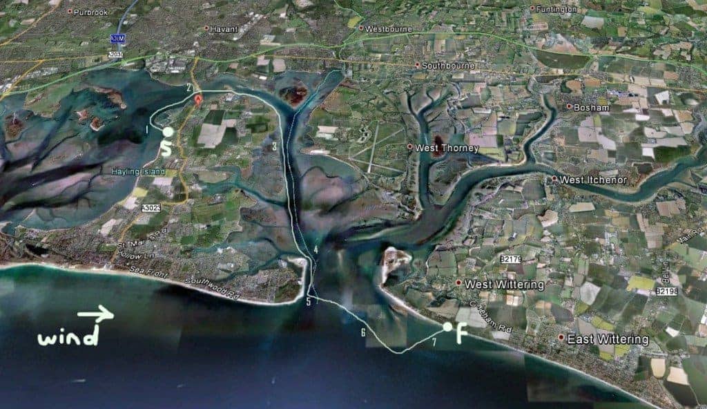
- You can see my start point “marked 1 on the map”. From here I paddled straight out over the gravel bar and around the point to the right. Smooth water all the way with the tiniest rolling swell picked up by the wind helped push me along.
- Carrying on towards the bridge at “map marker 2″ that brings you onto the island you come across big concrete blocks sticking out of the water. At high tide the majority of them are submerged so I headed for the biggest in the middle and went between them.NOTE: even on a slack tide the water was still squeezing through here and I had to paddle harder to keep moving on turbulent water.I think the concrete blocks were the supports for the original train line bridge that came onto the island many years ago.
- Not long after the blocks you have to paddle under the road bridge, but again be aware that water squeezes through here so position yourself dead centre of the supports as you go through.
- Once I got to this point the island was blocking off the wind so the water was super smooth and still. If you paddle closer to shore you go over the shallows and can check out the local fish.
- Coming round the northern most corner of the island you think you are now coming into Chichester Harbour, but you are now actalg Thorney Island. Wasn’t so bad mid autumn but in the summer there are loads of pleasure boats about so be careful.
- At “map marker 3″ I start to get affected by the wind again as it has open land heading straight out to me so had to stick to paddling one side for a while. Water was still smooth and again I headed into theshallows to try and reduce the wind effect, but it didn’t really work as the wind was picking up.
- At “map marker 4″ you are nearing the Hayling Island Yacht Club which is a superb venue and pretty friendly place so you can always park up here if you need a break. Water is still smooth but starting to get a head on rolling swell coming in from the sea just ahead.
- Keep paddling to the very corner of the island where you go past the lifeboat station. I decided to pull onto the beach here and call Kate to let her know my position and that I was going to cross the channel. At this point I was happily popping over some pretty big swells, easily shoulder high and steep. I think it must be that the are sand banks around you channelling the swell as just out to my left there is no swell to speak of so it was rude of me not to pick a couple of rides.NOTE: being the harbour mouth this is a busy place so stay close to shore and make sure the leash is attached as currents get very strong here.
- After ringing Kate I set off again and knelt down for a few minutes to get past the rougher water that had picked up. Luckily the wind was very westerly so I didn’t have to paddle to far out to get some rolling swells, but they weren’t that steep and I didn’t get many long rides.
- You can see on the map is “marker 6″. It marks the sand bars that surround West Wittering. Not much happening on them so I decided to stay further out to sea and keep paddling along the swells so I could then have a direct line in with the waves into Cakeham where I was landing.
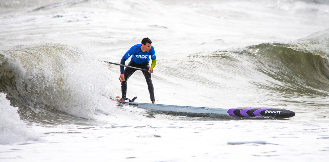
- “Map marker 7″ shows where I had a bit more fun as the waves jacked up a bit so I played around here surfing for a while. Cakeham doesn’t great waves as it is so protected by the sand bars further out but it is a nice beach to land on as a stop off point. From out at sea you can see that houses suddenly stop adn become fields and there is what looks like a tower with a flag on it.
My journey ended here as Kate picked me up and drove me back to Hayling to get the car, but you could easily paddle along to East Wittering for some grub.


